The problemGeological logging of diamond drill core underpins our understanding of the subsurface in mining projects. The process involves describing lithology, alteration, mineralisation, and many other features. Early on, it…
The problemGeological logging of diamond drill core underpins our understanding of the subsurface in mining projects. The process involves describing lithology, alteration, mineralisation, and many other features. Early on, it…
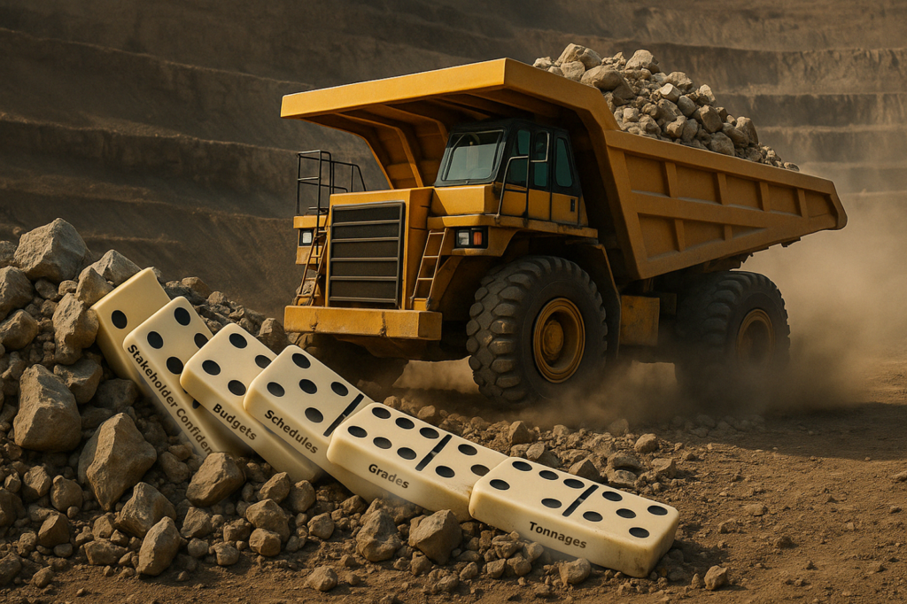
Created by Wendy Ware. Why better rock knowledge leads to more achievable plans — and how evolving data, shared understanding, and connected teams can close the gap between what is…
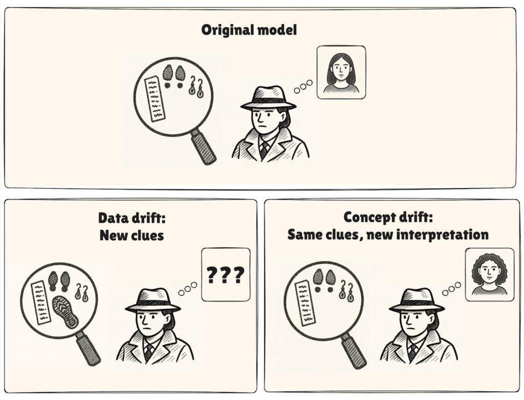
“I thought this model was supposed to work really well. Why has it started spitting out things that don’t make sense?” Machine learning models can bring huge benefits in exploration…
Created by Pouya Emami and Eleanor Mare If you’ve ever been involved with data science projects, you’ll know that they rarely go exactly as planned. As the team at Datarock…
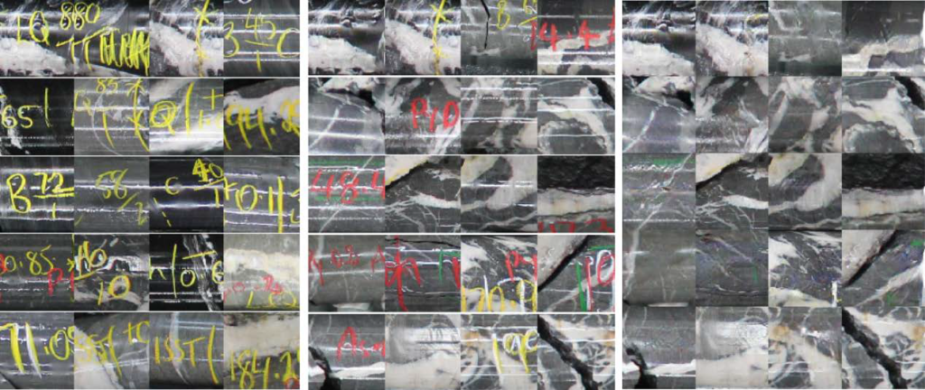
Created by Sam Johnson and Yasin Dagasan This blog post is a summary of Johnson et al., 2024. “Automated extraction of discing regions from core photography using computer vision at…
Created by Tom Schaap. This blog post is a summarisation of Schaap et al., 2024. Computer vision tools for geophysicists. Presented at the 1st ASEG DISCOVER Symposium 2024: 15 -18…
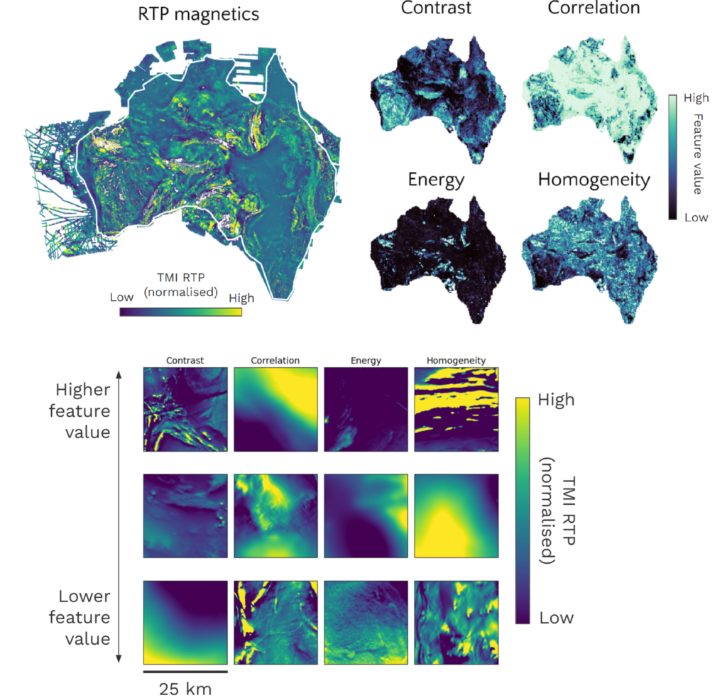
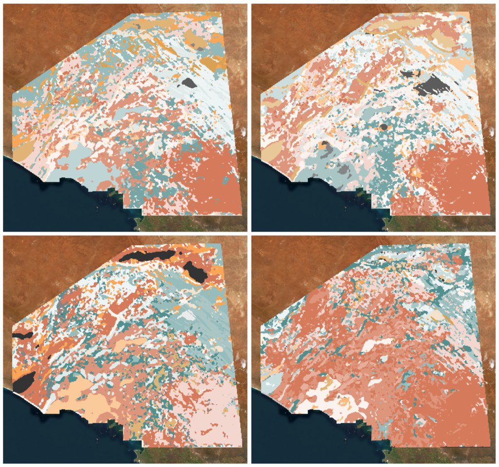
Created by Katie Silversides This blog is adapted from: Katie Silversides, Jack Maughan and Mark Pawley 2024, Mapping geology using textural feature extraction and unsupervised community detection models on airborne…
Created by Yasin Dagasan, Harvey Nguyen and Mark Grujic This blog is a republication of an accepted abstract published in the Australian Exploration Geoscience Conference (AEGC) 2021 conference proceedings. Summary…
Created by Luisa Herrmann and Brenton Crawford. I want AI to take the dull geology jobs so that I can explore… No! In a previous Datarock blog post article,…
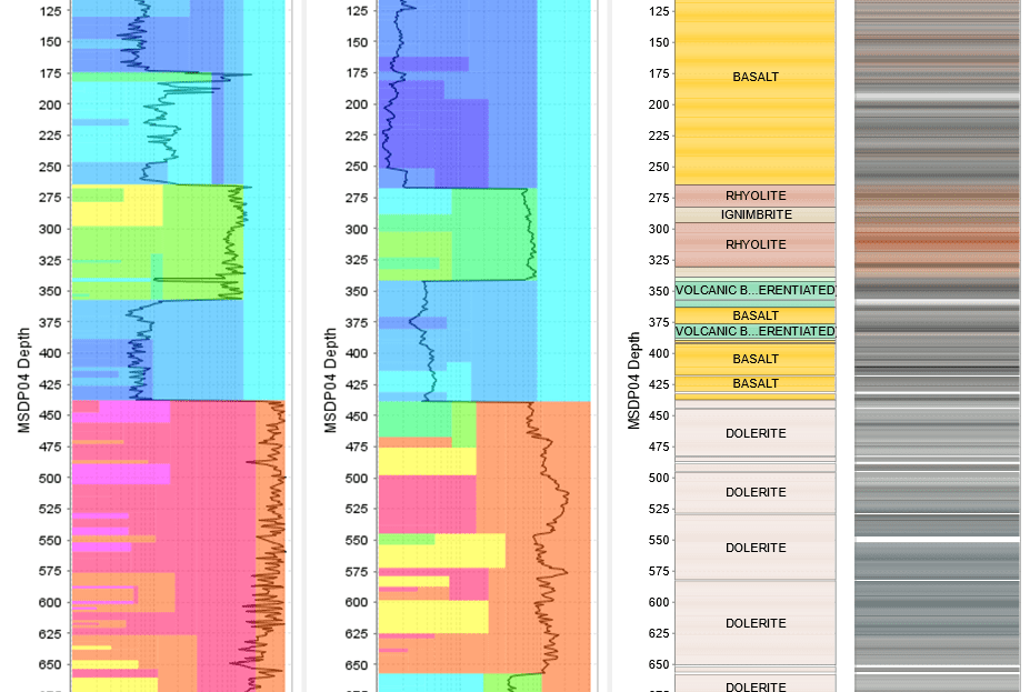
Created by Putra Sadikin, Brenton Crawford and Rian Dutch Overview Traditionally, core photography has been used by geologists and geotechnical engineers for visual inspection. However, it has seldom been utilised…
Level 3, 31 Queen
Street, Melbourne,
Victoria, Australia, 3000
Datarock needs the contact information you provide to us to contact you about our products and services. You may unsubscribe from these communications at any time. For information on our privacy practices and commitment to protecting your privacy, please review our Privacy Policy.
© 2025. All Rights Reserved.